Satellite Resource Tracker
Satellite Resource Tracker (SRT) harnesses the power of military-grade satellite technology to provide mineral exploration services for mining companies.
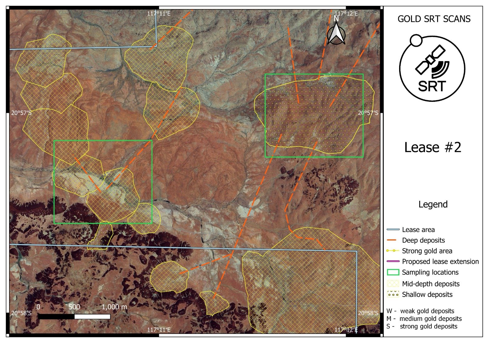
Compared to traditional methods of mineral exploration such as Geophysics and Aerial Magnetics, the SRT system provides accurate reflection imagery for specific minerals, using older satellites that have ground-penetrating frequencies.
Commencing in the late 1990s, a group of software engineers and mining experts joined forces to research the potential of using military satellites for private use. Through extensive fieldwork in Western Australia over a decade-long period, SRT has perfected their system and tested it in multiple countries.
SRT technology is able to detect gold deposits deep underground, using satellites that were designed to locate rocket silos during the Cold War. SRT also uses satellites designed for hunting atomic submarines to detect diamond deposits.
Always pushing the boundaries of what is possible with the technology, the latest discovery is the host rock of lithium, Jadarite.
The raw satellite data is overlaid onto Google Earth Maps, allowing our clients to easily review the broader area and plan their fieldwork.